

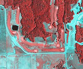
The satellite images, produced by French wine consultancy body ICV and geo-information provider Infoterra, give growers information on water stress and grape composition amongst others, allowing better management of the vinification.
The technology, called Oenoview, is a combination of aerial photographs and satellite imagery in the near-infrared, which provides growers and buyers with a complete picture of the vines’ vigour and the plot’s ‘terroir’ before the harvest.
Oenoview is based on an existing service for agriculture, but because of the smaller size of the plots a higher resolution was needed, Infoterra’s Innovation Manager Herve Poilve said.
“It allows the growers to visualise the observed variability of the vine at the level of the vineyard,” said Bruno Tisseyre, a lecturer at the Institute for Agronomic Research.
Vines’ variability can be affected by a number of factors, including soil water levels and mineral deficiencies.
“For the co-operative caves who buy the grapes they can know the potential quality and quantity of wine very early &ndash six weeks before the harvest,” Jacques Rousseau, head of ICV’s Vines and Wines Department told Reuters.
Oenoview not only allows growers to better estimate the potential value of their plot but also allows them to sort the grapes by quality. By putting similar grapes together, producers can reduce the risk of making low quality wine.
Under pressure
Rousseau added that in order to remain competitive, French wine growers need to produce more wine and better wine.
New World wines are becoming increasingly popular with consumers, as are those of European rivals Spain and Italy.
A study by the Credoc French research centre showed Spain could permanently overtake France as the world’s biggest wine producer as soon as 2015 because Spanish wine growers are improving the yield of their vines while the French are cutting back.